About 1.5 hours (95 km) west of Sydney lie the Blue Mountains – New South Wales’ most iconic national park and a World Heritage-listed preserve. The Blue Mountains don’t actually look much like mountains and, in fact, they are not. The geological landform is actually a dissected plateau, a plateau area that has undergone enough erosion to break apart the elevated expanse, giving rise to individual “peaks.” The Blue Mountains got their name from the characteristic blue haze that lingers in the valleys – the result of light scattering through the volatile oils which emanate from the dense eucalyptus forests. While perhaps not as impressive in elevation as some of the world’s true mountain ranges, the 3,900 square mile expanse is celebrated for its incredible plant diversity.
We ultimately decided to make the small, centrally-located town of Wentworth Falls our home base for a few days of hiking. Frankly, it was a prudent (if not fortuitous) decision given how much we quickly came to loathe the crowded and heavily-touristed trails of neighboring Katoomba. While the famed ‘Three Sisters’ and surrounding trails were woefully congested, this trail (as well as the couple others we explored) offered a starkly-contrasting serentiy. This particular route was recommended to us by our affable AirBnB host, who touted the walk as his favorite in the Blue Mountains.
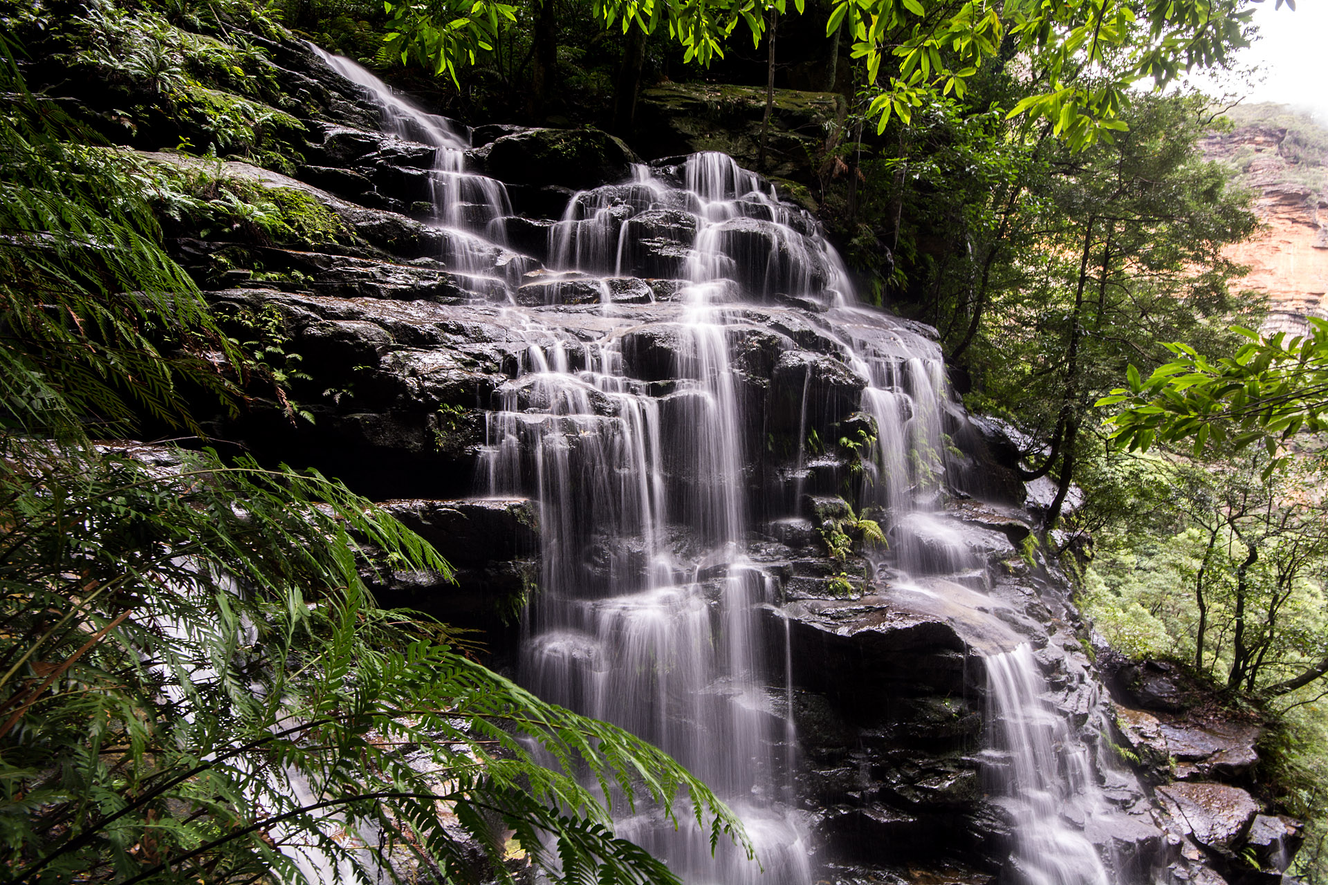
The hike begins at the Wentworth Falls Picnic Area, where a winding path leads down into the forest to the top of Wentworth Falls – a three-tiered, 600-foot (200-meter) waterfall at the end of Jamison Creek. As we approached the headwaters of the falls, an endangered Blue Mountains water skink caught our attention. Endemic to a swath of the Blue Mountains region, the rare lizard is, unfortunately, under threat from human development as well as the onerous feral cat population. Feeling extremely lucky to have had the brief encounter just minutes into our hike, we snapped a few photos before ensuring the striking reptile was safely off the path before we proceeded onward. Upon reaching the top of the falls, the trail crosses the pooling water and skirts the edge of the escarpment, where the roaring waters tumble to the lush valley below. A steep, stone staircase then descends to National Pass when, suddenly, the trail all but vanishes from sight. As we navigated the cliff’s edge (no worries, there’s a short, chain-link fence for safety), we were treated to stunning, unobstructed views of the surrounding plateaus – and a vertigo-inducing look straight down into the valley. This portion of the hike proved to be as wonderful as our host suggested, with precipitous stone staircases, paths carved directly into the side of the cliffs, and spectacular panoramas everywhere you looked. When we reached the Valley of the Waters, the forest grew lush and damp around the numerous waterfalls that speckle the area. From the waterfalls, the trail rapidly ascended, bringing us out of the valley and back along the cliff’s edge.


Towards the end of the hike, we briefly departed the Overcliff/Undercliff trail for the Den Fenella lookout, a short side-trip off the main track to a valley overlook. Our host informed us this was a good spot to try and catch a glimpse of a lyrebird – a large, ground-dwelling songbird (about a meter long) with a long, flowing tail that has an incredible ability to mimic virtually any noise it hears. In fact, roughly 80% of the lyrebird’s sounds are mimicry of both natural and man-made noises (check out this video from the BBC: https://www.youtube.com/watch?v=VjE0Kdfos4Y). Once again extremely fortuitous in the wildlife department, we managed to spot a female lyrebird diligently building her nest. We watched in awe for nearly 30 minutes, enthralled as the busy mom-to-be hunted fastidiously for just the right sticks, twigs and mouthfuls of leaf litter to construct the perfect nursery.


Total Distance: 5.3 miles
Elevation Gain: 945 feet


Alternate variation: National Pass/Wentworth Pass/Valley of The Waters
Because we enjoyed the serene and scenic area so much, we returned the following day for a variation of the previous hike. We began by retracing the start of our previous hike from Wentworth Falls to National Pass, enjoying yet another dizzying trip around the cliff’s edge. Instead of continuing along the length of National Pass, however, we descended down to Wentworth Pass via the Slack Stairs, a series of steep ladders that descend sharply to the bottom of the yawning valley. As we clambered down the metal rungs, sulfur-crested cockatoos called and chattered loudly at each other as we skirted their treetops, and we’d frequently stop to watch their antics as they socialized and chomped noisily on their breakfast in large family groups.
As soon as we reached the valley floor, the trail grew dark and damp – with dense vegetation flourishing in the abundance of moisture. The trail was isolated and silent, aside from the rustling foliage and the soothing trickle of flowing water, and an Australian water dragon startled both of us when he darted up a nearby rock along the otherwise deserted path. The colorful lizard appeared to be about as big as the creatures get – nearly a meter long and with beautiful red patterning on his chest and belly (an identifying characteristic of adult males).
Unfortunately, despite the weather report which assured us of clear skies, some steady rains set in about halfway into our hike, forcing us to pick up the pace and abandon some of our photography efforts. By the time we started up out of the Valley of the Waters (here rejoining the final part of the path we’d navigated on the previous hike), the stone staircases were slick with water, requiring a lot of care during the ascent. The end of the trail brought us past the same waterfalls we’d seen previously, their waters now roaring after the evening rains. Because of the conditions, instead of rejoining the second half of the Overcliff/Undercliff track, we scooted up the Shortcut Track – a slightly shorter, more-direct route back to the Wentworth Falls Picnic Area


Total Distance: 4.6 miles
Elevation Gain: 1,134 feet


