If you’re interested in venturing outside the borders of Canada’s mountain national parks, Kananaskis Country offers a wealth of opportunities for hiking and scrambling. Encompassing more than a million acres of wilderness along the front range of the Canadian Rockies, ‘K Country’ is easily accessible from the bustling hub of Canmore. With nine provincial and wildland provincial parks to explore, the handful of trails we explored in this special swath of Alberta were some of our favorites.
One of those trails took us to Burstall Pass. Running through Peter Lougheed Provincial Park – on the northwest side of Kananaskis Country – Burstall Pass borders the eastern fringe of Banff National Park. If you hike to the top of the pass, without any additional wandering, the out-and-back route clocks in at roughly 10 miles (16 km) with a moderate 2,000 feet (600 m) of vertical gain.


The Burstall Pass Trailhead sits immediately off the Smith Dorrien Trail (Highway 742), about 30 miles (45 km) south of Canmore and just across the street from the hugely popular Chester Lake Trailhead. As we probably should have anticipated with a more moderate trail, we did encounter a fair number of other hikers on a stunning fall Saturday that, coincidentally, turned out to also be a peak larch weekend. When we booked our stay at nearby Mount Engadine Lodge for the first weekend in October, we thought we’d maybe catch the tail end of the larches’ fleeting fall show. However, with an unseasonably warm, extended summer delaying the conifers’ turn, we unexpectedly found ourselves in Kananaskis at the height of color. Consequently, there was a bit more foot traffic on the well-trodden trail.
For the first couple miles (3 km), the trail is largely flat and unexciting, following the vestiges of an old logging road through the forest. Admittedly, we were initially unimpressed, so much so that we even started questioning our route selection for the day. Luckily, the wide road eventually gave way to a proper trail, and we suddenly found ourselves on a large alluvial plain, surrounded by willows and peaks on all sides. To the south, we got a sweeping look up at Robertson Glacier, tucked between the narrow pinnacle of Mt. Robertson and massive Mt. Sir Douglas.


For the next 0.7 miles (1 km) or so, the trail continued across the wetlands surrounding Burstall Creek. Even in dry conditions, this stretch can be pretty wet and muddy, so make sure you’ve got appropriate footwear. At around 3 miles (5 km) from the trailhead, the path finally began its uphill climb, switchbacking through another short section of forest en route to the pass.
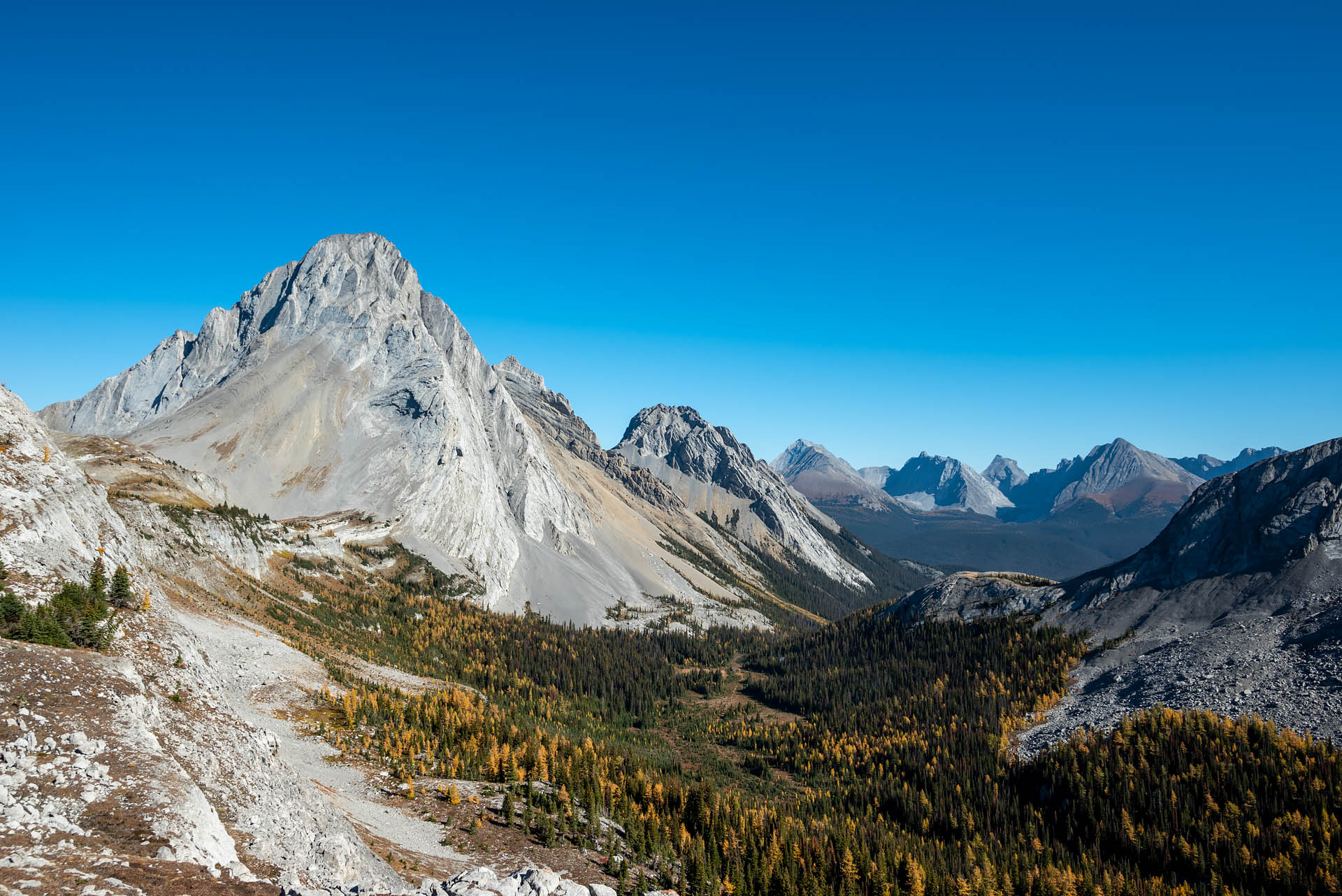
The trail popped out of the tree line just before the top of the pass, and we were suddenly met with some gorgeous views of Mt. Birdwood, Pigs Tail and Commonwealth Peak to the north. When we finally gained the pass, golden larches dominated the landscape, with the southern sun illuminating neighboring Snow Peak as well as the peaks of Banff’s Blue Range to our west.


Atop the pass, the trail forked hiker’s left to a quiet bluff overlooking Banff’s Leman Lake. Sitting at the southern end of the Spray River Valley, Mounts Leman and Leval rise on either side of the small pool, with Shark’s Fin and Mt. Soderholm rising in the distance. The larches here were a stunning shade of gold, and we couldn’t believe the fortuitous timing of our visit.


Not realizing the trail would be as moderate as it was, we ended up making it to the top of the pass in about an hour and a half. Somewhat taken aback by the time, I looked down at my Garmin wondering where we’d go from there. It was a stunner of a fall day, and we certainly wanted to spend more time soaking up the gorgeous weather and scenery, rather than just returning to the car.
Had we known there was an attainable scrambling route up to Snow Peak, we certainly would have chosen to bag that summit while standing directly underneath. Unfortunately, in our rare moment of unpreparedness with connecting routes, we instead decided to head around the north side of the peak toward Birdwood Pass. As we made our way between Snow Peak and Mt. Birdwood, there was occasionally a whisper of trail, but it certainly didn’t appear to be a well-traveled route. It was beautiful and not a soul was out there, but we would have loved to have tacked on a little scramble.


After walking for a couple miles, we arbitrarily chose a stopping point along the ridge. Here, we enjoyed a quiet lunch spot all to ourselves with views out to Mount Smutwood, Mount Smuts, and a handful of other peaks surrounding the larch-flecked Spray River Valley. It was a gorgeous spot, and the seemingly endless stretch of trail just begged for us to keep going. While our Gaia app suggested we could have continued all the way back to Commonwealth Valley – back near our cabin at Mt. Engadine – we had no shuttle vehicle to return us to our starting point. Consequently, we headed back toward Burstall Pass. Although we were somewhat disappointed with the decision, it turned out to be a stroke of luck. We later learned that the Commonwealth Valley trails were closed because of a bluff charge by a grizzly mother. Just one more reminder that it doesn’t pay to slack on trail research, even once.


Once we were finally able to pull ourselves away from the beautiful views, we made our way back to Burstall Pass and out the same way we’d hiked in. While we may have not capitalized on all the potential routes accessed from the pass, our six-hour return did leave us with enough time to enjoy the lavish afternoon tea that was included with our stay at Mt. Engadine. Sanchez had never been treated to such an elaborate charcuterie board after a hike, but quickly let us know this was a ritual she would easily be on board with.


If you’re looking for a bang-for-your-buck trail in Kananaskis, Burstall Pass is certainly worthy of consideration. If you find yourself here during larch season, it’s a shockingly good spot to enjoy the golden conifers. Better still, if you start early and enjoy a relaxing trip up to the pass, you can cap it all off with a lovely high tea while soaking up some afternoon sun at the Mt. Engadine Lodge. Really, we can’t think of a much better way to spend a day.


Total distance: 14.6 miles (km)
Elevation gain: 2,871 feet (m)


