For those looking to get out and explore the heart of the Grand Canyon, two of the park’s iconic South Rim trails can be combined into one epic day hike. The route is challenging, especially in the heat, and clocks in at just over eighteen miles with almost 4,900’ of elevation gain. If you’re experienced hiker looking for an unforgettable outing, this thru hike combines the South Kaibab and Bright Angel Trails with a stop at historic Phantom Ranch.
Many people hike to Phantom Ranch or one of the backcountry campsites (Bright Angel Campground or Indian Garden Campground) as an overnight trip, often as part of a two-day Rim-to-Rim hike. The true Rim-to-Rim involves hiking one of the two South Rim trails, crossing the river, and finishing on the North Kaibab Trail (or the reverse). While it is possible to do a true Rim-to-Rim in a day, there are a few impediments. First, the Grand Canyon’s North Rim is only open from mid-May to mid-October due to snow. Depending on the season you visit, the North Rim may be inaccessible. Additionally, the route is a bit longer – about 20 miles total with 1,000’ more elevation gain than the South Rim-river-South Rim. The biggest obstacle for us, though, was the driving distance between the two trailheads – a solid four hours. For us, having a dog waiting anxiously at home completely eliminated this as an option.
If the true Rim-to-Rim is out of reach for one reason or another, the more accessible South Rim-river-South-Rim is a nice option. And while it is possible to hike in a single day if you’re a strong hiker, the national park strongly discourages visitors from hiking to the river and back in a single day. In fact, you’ll see signs posted regularly along the trail warning against it. If you’re an experienced hiker, a day hike is totally achievable. That said, many people overestimate their abilities as well as just how difficult the trail can be in the heat. Consequently, rescues are not uncommon. Before considering this as a day hike, make sure you are properly trained, well-prepared, and have done your research. The national park’s Hiking FAQ page is a great place to start.

Getting there
There is no public parking available at the South Kaibab Trailhead. The road is open only to shuttles and park vehicles. The easiest option for thru hiking is to park near the Bright Angel Lodge or Backcountry Information Center and take the Hikers’ Express Shuttle Bus to South Kaibab to begin the hike.
The Hikers’ Express is free and the most convenient option for getting to the South Kaibab Trailhead. The bus departs the Bright Angel Lodge two or three times each morning on the hour. It then makes two additional stops at the Backcountry Information Center and Visitor Center Shuttle Bus Terminal before arriving at the South Kaibab Trailhead. Be sure to check the schedule for the month you are visiting, as shuttle hours vary throughout the year.
There are alternate options, but we found the Hikers’ Express from Bright Angel Lodge to the be the easiest. Getting on the shuttle at the first stop ensured we got a seat on the bus (I have no idea how crowded the shuttle is during busier months, but we didn’t want to risk it). Additionally, parking near the hike’s endpoint allowed us to get right into our car when we finished. After a long, hot day on the trail, who wants to wait around for a shuttle? If you do need an alternative, however, here are a few suggestions:
- Park at the Visitor Center Plaza and take the orange route (East Kaibab Rim) directly to the trailhead. This means, of course, you’ll need to catch a return shuttle from Bright Angel Lodge back to the Visitor Center at the end of your hike.
- Park at Pipe Creek Vista and walk the Rim Trail for 0.8 miles to the South Kaibab Trailhead. Downsides: It adds a little distance to the hike and, again, you’ll need a return shuttle to the viewpoint after hiking.
- Park at Bright Angel Lodge and hike the trail in the opposite direction. If you do, be aware there will be slightly more elevation gain this way (about 400’). Additionally, you guessed it, you’ll need to wait for a return shuttle from the South Kaibab Trailhead back to the lodge.

The hike
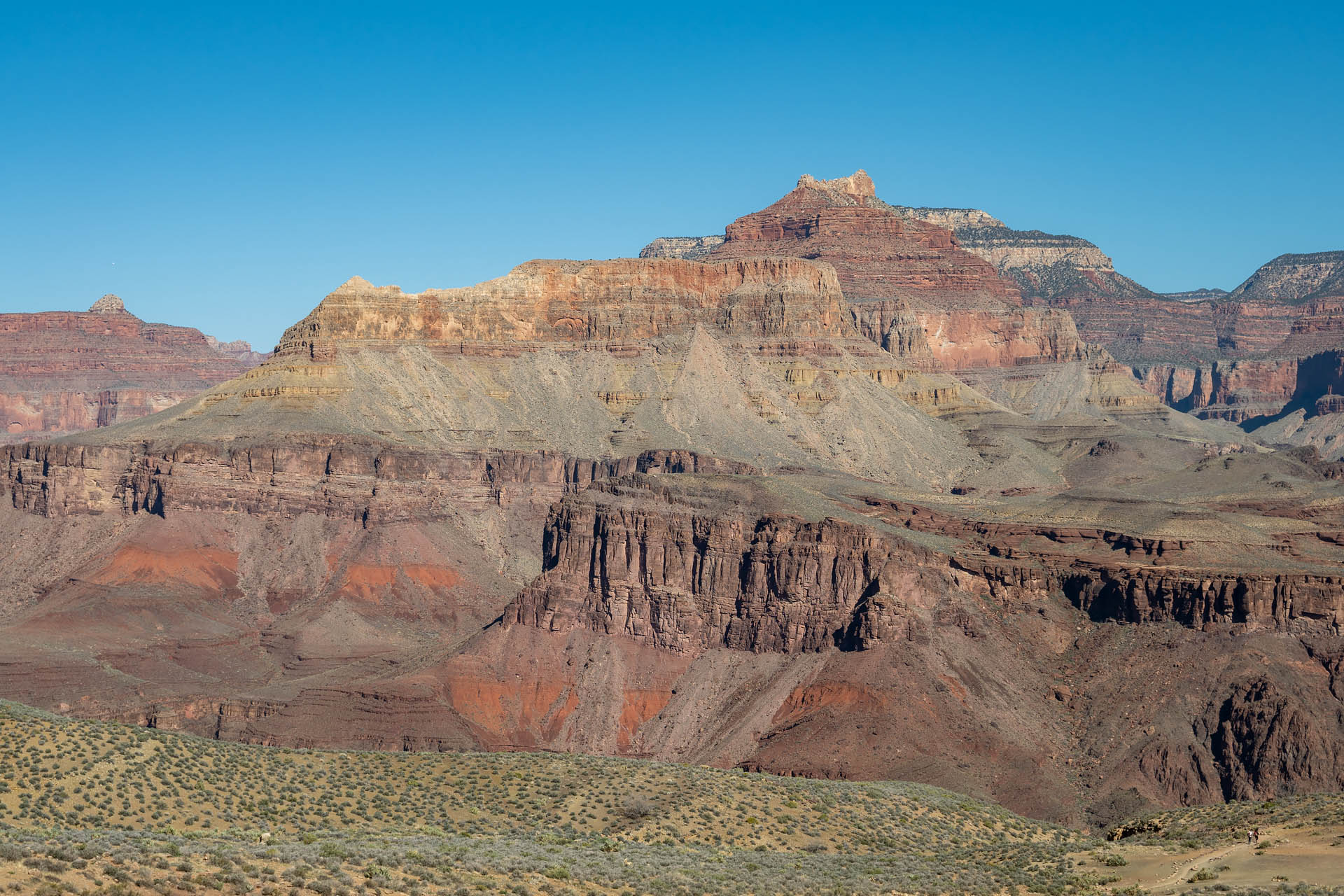
Beginning from the South Kaibab Trailhead at an elevation of 7,260 feet, the trail begins its descent into the canyon via a series of wide switchbacks. After about a mile, the trail opens onto the first signed vista, Ooh Aah Point. Sitting at an elevation of 6,600 feet, the rocky outcropping offers a nice view of the canyon’s colorful layers – unveiling 1.8 billion years of Earth’s geological history. Below, you can see the trail as it winds around the eastern side of O’Neill Butte.


From Ooh Aah Point, it’s a short, half-mile walk down to Cedar Ridge. At an elevation of 6,000 feet, the flat projection offers even more sweeping views, including a look at the iconic Vishnu Temple to the east.


From Cedar Ridge, the trail wraps around O’Neill Butte before making a straight and more gradual descent to Skeleton Point. When you reach Skeleton Point, you’ve lost about half your total elevation. At an elevation of around 5,000 feet, the views from Skeleton Point were some of my favorites. This is a particularly scenic spot, and you get a fantastic look at Zoroaster Temple (north) and Vishnu Temple (east). If you’re in search of a shorter day hike into the canyon, the round-trip from the trailhead to Skeleton Point is a nice option – clocking in at about six miles with 2,200’ vertical gain.


From Skeleton Point, the trail once again descends a series of switchbacks around another small butte. It then levels off a bit as it traverses the Tonto Platform, a wide bench that separates the upper part of the canyon from the inner gorge. Here, the trail intersects with the Tonto Trail at the Tipoff. Just before the trail drops down from the Tipoff into the inner river gorge, there are some gorgeous views looking down on the river.


As the trail zigzags down toward the river, it loosely follows the vestiges of the Cable Trail. The bygone route was once used to access the old cable car that crossed the river prior to the construction of the Kaibab Suspension Bridge. This was probably my favorite stretch of trail in the canyon. The path here is a brilliant shade of burnt umber, and it felt like the walls of the canyon were really starting to envelop you as you watched Zoroaster’s once-lofty crown shrink quietly into the landscape.


At just over six and a half miles from the trailhead, you reach the Black Bridge (Kaibab Suspension Bridge) which leads you across the Colorado to the other side of the canyon. Built in 1928, construction of the bridge’s 440-foot-long span was both difficult and dangerous. More than one hundred tons of materials were carried into the canyon entirely by mules or manpower. The one-ton, 550-foot-long suspension cables were hauled down nine miles and 4,000 vertical feet by forty-two Havasupai tribesman, while dozens of other workers dangled in slings above the raging Colorado River to install supports.


After crossing the river, we couldn’t leave the canyon without making a quick, two-mile round-trip detour to Phantom Ranch. With that, we headed north from the river through Bright Angel Canyon to check out the historic lodging. Phantom Ranch opened in 1922, three years after the Grand Canyon was incorporated into the National Park System. Since that time, it’s been a coveted accommodation by canyon visitors. The ranch is tucked away inside Bright Angel Canyon – a lush little valley of cottonwood trees that line the banks of Bright Angel Creek.


We followed the ribbon of greenery to the ranch’s collection of small cabins, pausing to reapply sunscreen, enjoy a quick lunch in the shade, and indulge some lemonade from the canteen. I have to say, there’s not much that tastes better than an ice-cold cup of lemonade after eight miles of hiking in 80-degree temps.


Eventually, we departed the ranch for the return trip to the rim, heading back to the muddy Colorado and crossing over the Silver Bridge (Bright Angel Suspension Bridge). Built in the 1960s, this 500-foot-long span sits just downstream from the Black Bridge and provides the support structure for the Transcanyon Water Distribution Pipeline – the system that supplies all potable water to the South Rim.


From the second bridge, it was a 9.5-mile return via the Bright Angel Trail, gaining back the entirety of the 4,900 vertical feet we lost en route to the canyon’s floor. The route was pretty moderate, thought the heat and inescapable sun rays made it feel like much more of a slog than it actually was.


With the path paralleling Pipe and Garden Creeks for several miles, it was interesting to see how much more vegetation was on this side of the canyon. Although it’s just a few kilometers west of the parched South Kaibab Trail, the little bit of water creates a totally different landscape.


When we reached Indian Garden, about 4.5 miles from the Bright Angel Lodge, we stopped briefly to refill our water supply. After being largely alone for much of the trail, this seemed to be the point where we returned to civilization. The foot traffic from here to the rim was fairly moderate, although not nearly as heavy as we expected for a beautiful spring Saturday.
For us, the highlight of the Bright Angel Trail was spotting a fallen boulder crisscrossed with the footprints of an early reptilian dinosaur. Back in 2016, Norwegian geologist Allan Krill was hiking the trail when he randomly spotted the collapsed rock. He noticed the curious imprints and contacted a colleague at nearby UNLV. The research team in Nevada determined the impressions were the fossilized footprints of a lateral-walking reptile that had been ascending a sandy dunefield during the Pennsylvanian Epoch. At 313 million years old, they are not only the oldest vertebrate tracks found in the national park, but also some of the earliest evidence of basal amniotes (egg-laying land animals) in the world. I love the story – such an amazing and implausible find. For my fellow science geeks, here’s a link to the full manuscript, published in PLOS One (2020).


Still giddy from spotting the inconspicuous block of sandstone along the trail, we made one final push up a series of steady switchbacks from the Three Mile Resthouse to the Bright Angel Lodge. As we approached the last tunnel just before the rim, we were treated to one final surprise – a lone bighorn sheep perched on a rocky outcropping. It was a humble reminder of just how awesome these animals’ climbing skills are, and he (or she) was clearly enjoying the sweeping canyon view.


Even though it was hotter than hell and we were drenched in sweat (as evidenced by my hat below), we had a great day on the trail. Our hikes typically involve climbing through thick forests up to some sort of alpine summit – and in significantly cooler temperatures – so this one was both unique and memorable. Perhaps we’ll return someday (doggy babysitter in tow) to take on a true Rim-to-Rim day hike.

Total distance: 18.2 miles
Elevation gain: 4,858 feet


Know before you go:
- Always carry your own water and know where you can refill with potable water. There are a number of water stations along the canyon’s Corridor Trails (trails below the rim), though only a few are open year-round. Check the Backcountry Updates & Closures page for information on access to water and other facilities. In addition to carrying (some) water, we always hike with both a manual filter as well as iodine tablets in case we need to fill up from a creek or stream. Beware: there is no water on the South Kaibab Trail.
- Don’t underestimate the sun and heat. We are fast hikers and the 80-degree temps and full sun noticeably slowed our pace. We hiked the first weekend in April, and temps down in the canyon were around 82°F. During the summer months, the interior of the canyon frequently sees temperatures above 100°F. There is virtually no shade along the trail, and the sun is seriously intense. Personally, there’s no way in hell I would do this in the dead of summer unless starting out super early (pre-sunrise). Even then, I’d probably still take a pass.
- Dress in layers. Weather varies greatly between the rim and bottom of the canyon. On average, temperatures increase 5.5°F with every 1,000’ of elevation loss. This means you can expect temperatures to be at least 30°F warmer in the canyon relative to your starting point on the rim.
- From the various hike reports we read, the average hiking time for this route (including Phantom Ranch) seems to be around 11–12 hours. This will vary wildly, of course, depending on your abilities. Make sure to save yourself more time than you think you’ll need. Depending on where you park and what shuttle(s) you need to catch, you want to make sure you don’t miss the last bus of the day. Check the shuttle schedule for detailed operating hours and maps.
- While the route can be hiked in either direction, there are a few advantages to starting out on South Kaibab and returning via Bright Angel:
- There are more opportunities to refill water at the end of your hike. There are several water stations along the Bright Angel Trail (depending on season), whereas there is no water along the South Kaibab Trail.
- You finish your hike where you parked (Bright Angel Lodge, Backcountry Information Center), assuming you took the Hikers’ Express. This eliminates the need to wait on a shuttle to return you to your vehicle after your hike.
- If you prefer less elevation gain, there are about 400 fewer vertical feet in this direction. The Bright Angel Trailhead sits at an elevation of 6,850 feet whereas the South Kaibab is at 7,260 feet.


