Columbine Lake is somewhat of a hidden gem. Just north of the Ice Lakes Basin, and about 7 miles from Silverton just off the Million Dollar Highway, the trail is reasonably accessible but still quite lightly trafficked. The road to the trailhead is somewhat of a challenge. While our Crosstrek made it, it would certainly be unlikely for a low-clearance or two-wheel-drive vehicle. There’s also virtually no parking at the trailhead. If you want to hike this trail, the best option would be to park near the bridge before the road forks to the right (there’s ample parking here) and walk the extra mile or so up to the start.

The first half of the route is fairly steep, climbing ~2,200 vertical feet over roughly two miles. The first mile ascends a series of 15 switchbacks that gain about 1,200 vertical feet through thick pine woodlands. At the top of the switchbacks, the trail then emerges from the tree line into a sweeping basin. From here, the path continues its steady climb through the basin up to a rocky saddle. From the higher elevation, you can see now the trail cutting through the rugged terrain in either direction.


From the saddle, the trail then levels off significantly, gaining just a few hundred feet over the next couple miles. As it snakes through alpine meadows, the path beings to skirt the banks of Mill Creek as it approaches the lake. As we turned a shaded corner just before reaching Columbine Lake, Sanchez jumped backward to the sound of flapping feathers. We’d unwittingly stumbled upon a covey of about seven white-tailed ptarmigan scampering around the rock-strewn hillside. Thinking we wouldn’t see them, they all froze motionless amongst the scree. Their instinct to remain still was certainly spot-on. As Sanchez and I backed away to give them some space while Stephan snapped a few shots, Stephan didn’t even notice the bird closest to him, its mottled plumage perfectly disguising it amongst the desiccated grasses and stones.


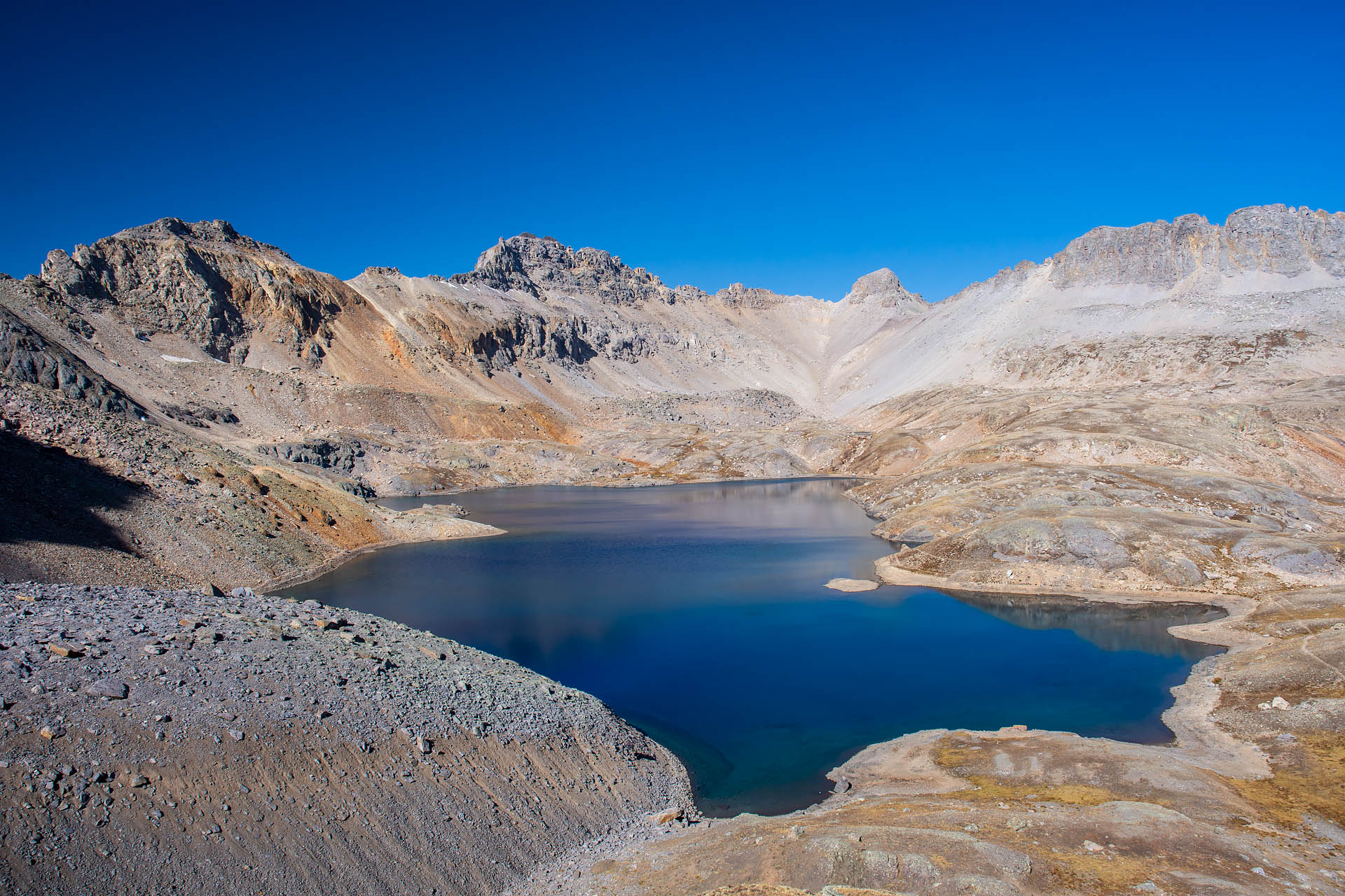
While the ptarmigan may have stolen the spotlight, Columbine Lake wasn’t too shabby. Sitting in a glacial bowl at around 12,700 feet, the lake is almost implausibly blue. We wandered leisurely around the lakeshore for a while, captivated by the lake’s shifting hues. As the depths and sunlight changed, the water’s surface morphed from a deep indigo to a more muted cornflower to an intense shade of cerulean. The color variations were almost magical, with the lake just begging to be photographed from every angle.


Wanting a better view of the lake, we scurried to the top of a short knob to the east. The colors were just as entrancing from above, and the intense blue was exceedingly striking against the barren backdrop of Lookout and South Lookout Peaks.
The return to the trailhead was even more beautiful than the hike up. Because the trail ran generally east to west, the early morning light precluded any meaningful views back into the basin and out to the ruddy peaks east of the Million Dollar Highway. The glow of the afternoon sun, however, perfectly illuminated the rusty summits of Ohio Peak and Anvil Mountain, making for a particularly scenic descent.


On the whole, we absolutely loved this trail. It was significantly less trafficked than Ice Lakes Basin, and the lake is just as astonishingly blue as Ice Lake Basin’s more photographed pools. After just a couple of hikes in the area, we were really starting to fall in love with Colorado’s San Juans.
Total distance: 7.8 miles
Elevation gain: 2,703 feet


